Pythagorean Theorem In The Coordinate Plane: A Complete Guide
The Pythagorean Theorem is a cornerstone of geometry, and its power extends far beyond simple right‑triangle problems. When points are plotted on a coordinate plane, the theorem becomes a quick way to calculate distances, slopes, and even verify whether a triangle is right‑angled. This article explains how to apply the Pythagorean Theorem in the coordinate plane, step by step, and highlights free resources that can deepen your understanding.
Why the Theorem Works on a Grid
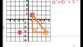
In a Cartesian coordinate system, any two points (x₁, y₁) and (x₂, y₂) form a line segment that can be thought of as the hypotenuse of a right triangle. The horizontal leg measures |x₂ − x₁| and the vertical leg measures |y₂ − y₁|. By the Pythagorean Theorem, the length of the hypotenuse (the distance between the points) is the square root of the sum of the squares of these legs.
Deriving the Distance Formula
Starting from the classic statement a² + b² = c² for a right triangle:
- Let a be the horizontal difference: a = x₂ − x₁.
- Let b be the vertical difference: b = y₂ − y₁.
- Substitute into the theorem: (x₂ − x₁)² + (y₂ − y₁)² = c².
- Take the square root of both sides to solve for c, the distance:
c = √[(x₂ − x₁)² + (y₂ − y₁)²]
This is the familiar distance formula used in algebra, geometry, and computer graphics.
Step‑by‑Step Example
Suppose you need the distance between the points A(3, 4) and B(9, ‑2).
- Find the horizontal difference: x₂ − x₁ = 9 − 3 = 6.
- Find the vertical difference: y₂ − y₁ = -2 − 4 = -6. (The absolute value is not required because squaring removes the sign.)
- Square each difference: 6² = 36 and (-6)² = 36.
- Add the squares: 36 + 36 = 72.
- Take the square root: